From iron curtain to green corridor
TEXT & PHOTOS: XANDER BRETT
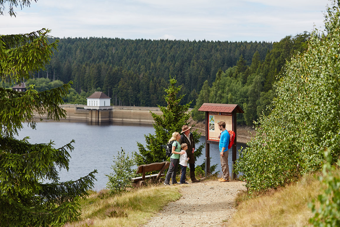
The Eckertalsperre. Photo: Harzer Tourismusverband, M Gloger
At first, I could not see much of the Harz Mountains. Though it soon cleared, mist – and a certain layer of mystery – was bathing thick forest as the bus swept downhill. I was making a short journey to the small settlement of Eckertal, having set off from Bad Harzburg, a spa town nestled about 90 kilometres southeast of Hanover.
What today is a united Germany’s heart stood, for much of the last century, on the demarcation of west and east. Disembarking at Eckertal, I faced a large brown sign whose white text reminded passing drivers of the fact. Here, the division of West and East Germany is today a boundary between the states of Lower Saxony and Saxony-Anhalt, identifiable only by a small contrast in road surfaces.
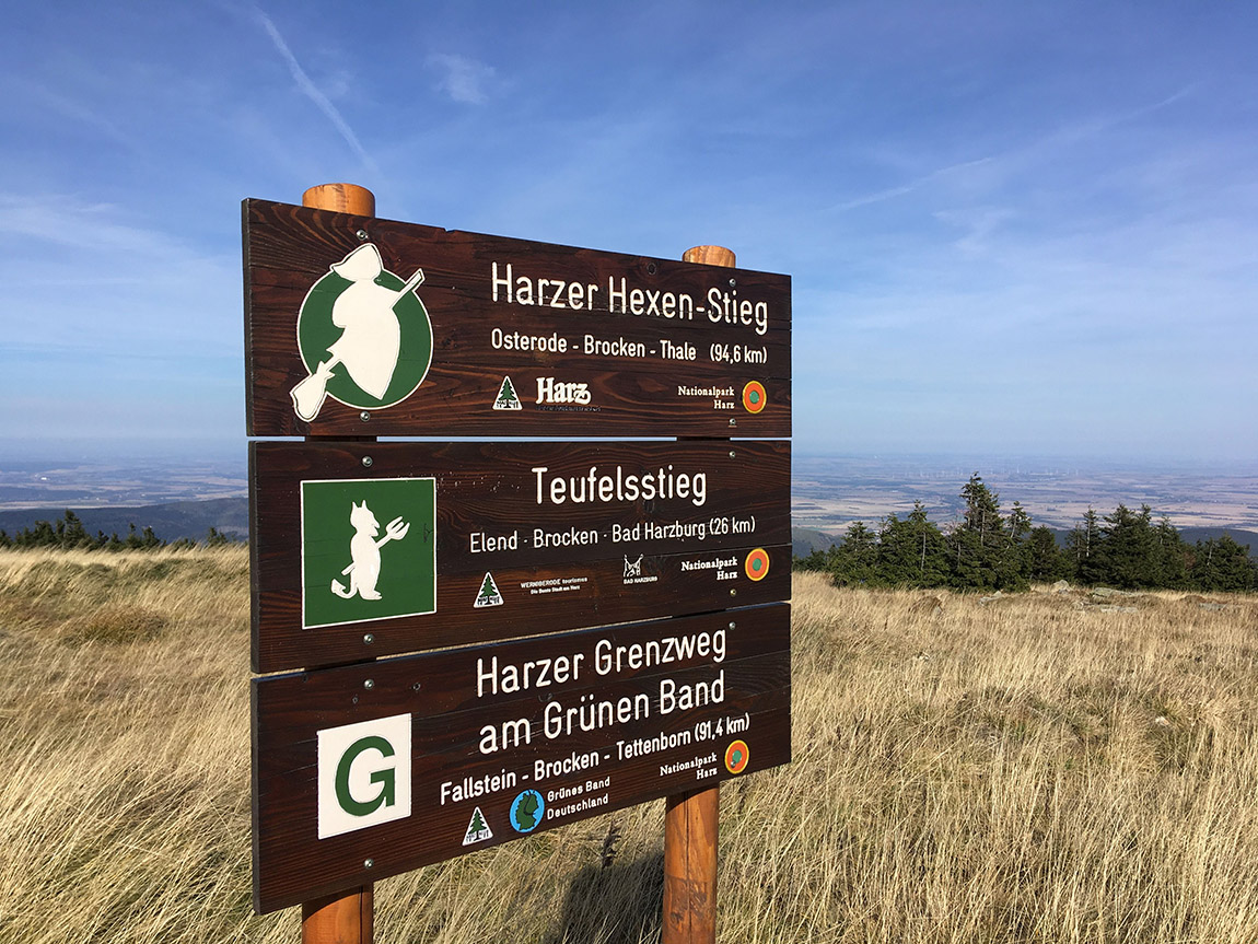
A sign on the summit of Brocken. Photo: S Wiedekind.
Much, indeed, has changed in the 36 years since 9 November 1989, when both the Berlin Wall and Germany’s wider partition were rendered useless. The village of Stapelburg, just east of Eckertal, is awash with houses constructed after communism’s collapse. Trees and agriculture have stubbed out most of what was one of the world’s most closely guarded strips.
The German Democratic Republic (so called, given that for most of its existence it was not particularly democratic), was founded in 1949, a direct successor to the Soviet occupation zone. It was not, however, until the early 1950s that the construction of border defences began.
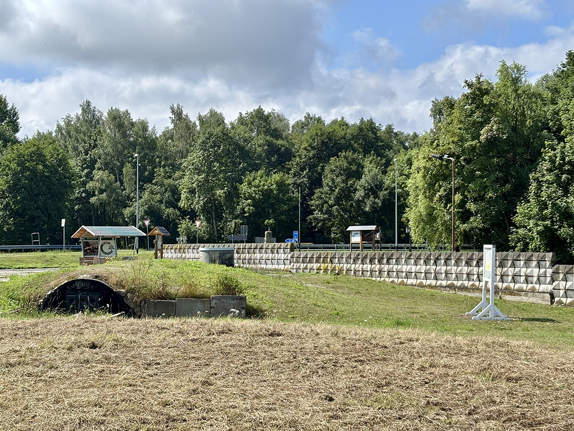
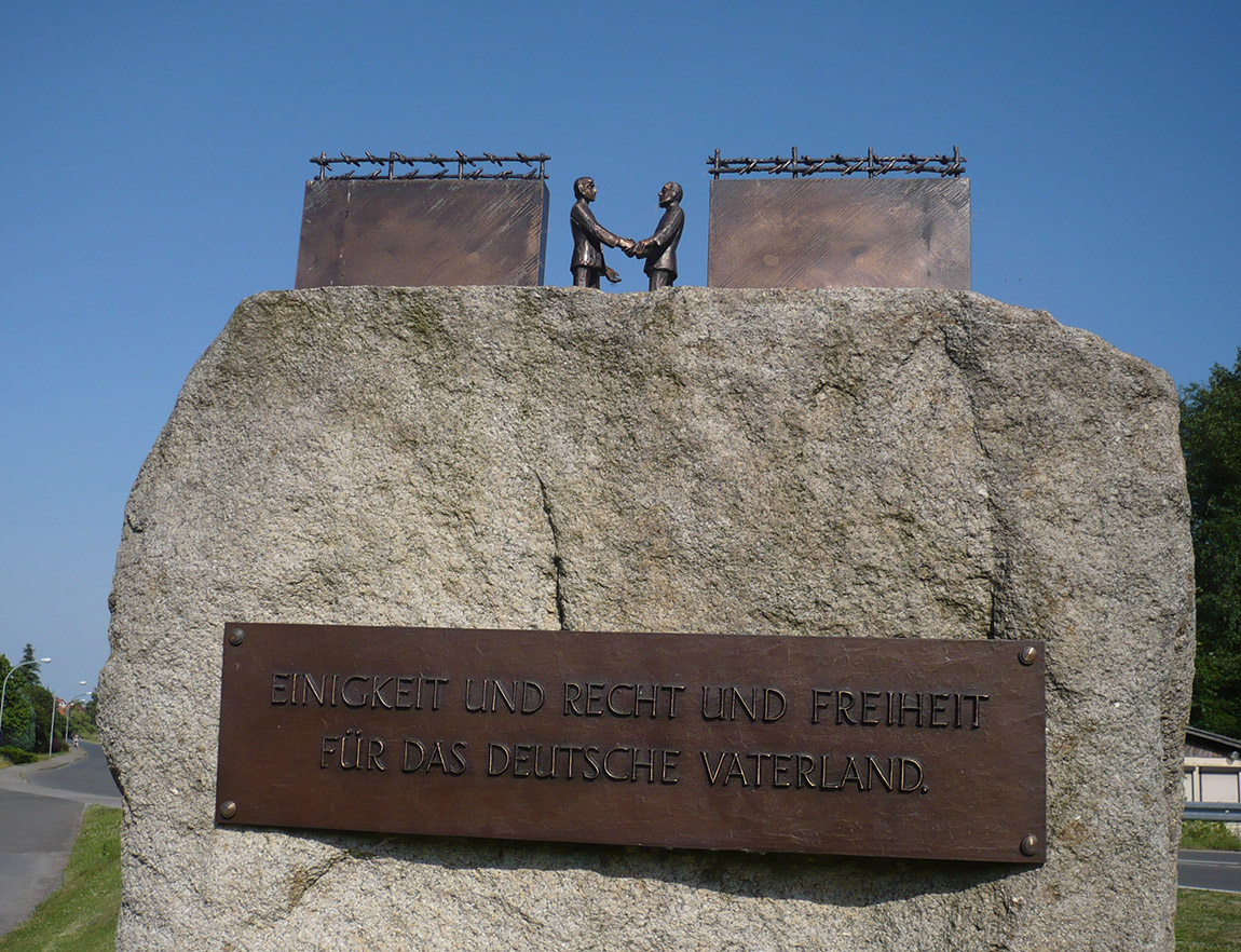
A preserved section of wall at Eckertal.
This means that the period since the Inner German Border’s dismantling has now lasted almost as long as the time in which fortifications were in place. Despite the intervening decades, the border lives on – and not only via signs, memorials and odd sections of preserved barriers.
For years, its precincts saw little human activity, not least on the eastern side, where access was controlled and many households forced to resettle. By the 1970s, biologists found wildlife flourishing in border regions absent of substantial human intervention.
In December 1989, only a month after the Berlin Wall collapsed, environmentalists signed the Green Belt Declaration of Hof, initiating efforts to preserve what had become an inadvertent wildlife reserve. By the early 2000s, it had grown into a pan-European movement. Today, a European Green Belt winds all the way from northern Finland to the Balkans, tracing the route of the former Iron Curtain.
Near Bad Harzburg, the corridor incorporates the 91-kilometre Harz Border Trail (Harzer Grenzweg), inaugurated in 2006 with help from the late Benno ‘Broken-Benno’ Wolfgang Schmidt, who scaled the region’s Brocken mountain over 9,000 times.
The trail starts below the hills at Hornburg and takes in the aforementioned Brocken, northern Germany’s highest peak and a military exclusion zone when it fell in East German territory. It moves past the ski town of Braunlage and finishes near the village of Tettenborn on the other side of the mountain range.
“We have 11,000 members in 78 branch associations,” shares Annett Drache, managing director of Harzklub, an organisation responsible for signage on the Harz Border Trail. From 2007 to 2010, Drache explains, Harzklub participated in the Erlebnis Grünes Band project.
A monument at Eckertal. Photo: Annett Drache
“Shelters and benches need to be regularly repaired,” she continues. “Signposts need to be erected, and bridges and observation towers need to be maintained. About 55,000 volunteer hours are spent annually on the maintenance of trails.”
Drache, who grew up in Dresden when it was part of East Germany, likens the various sections of the Green Belt to a string of pearls, and says that her favourite part of the Harz Border Trail runs from Grenzmuseum Sorge to Walkenried. She adds, however, that Brocken is also “very special” – given its status as a symbol of German unity.
“The reopening of Brocken was one of the most important events in the Harz Mountains,” Drache clarifies, adding that in April 1990, Harzklub helped publish one of the first cross-border hiking maps in Germany. “Since 1989, members of Harzklub have met annually on 3 December, to commemorate the time when an impregnable border separated the eastern and western parts of the Harz Mountains and climbing Brocken seemed a distant memory.”
A communications tower built on Brocken in the 1970s still stands, while at Eckertal some border defences have been given leave to remain, employed as reminders of the Iron Curtain’s all too literal manifestation. There is a concrete circle, once the base of a watchtower, and a still-standing section of the wall that buttressed it.
As I worked my way through Eckertal’s copious interpretation boards, I met 56-year-old Arndt Uchtmann from Osnabrück, near Münster, his rucksack overflowing with maps and leaflets. Uchtmann was hiking in the area, photographing the former frontier for his sister.
“I think it’s important that people learn about the division of Germany,” he affirmed. “I didn’t come here when the border existed, but I went to West Berlin three times. There was a certain atmosphere in the city back then.”
Like Uchtmann, most hikers come not only to view leftovers of a divided nation, at times following remnants of the Kolonnenweg patrol road, but also with ambitions to embrace the quiet beauty of Harz National Park, which is spread across a mountain chain that is possibly little-known outside Germany. Some might pick up a booklet from a tourist information office, collecting stamps from wooden boxes along their journey and, on completion, exchanging them for a congratulatory badge of honour.
After crossing Eckertalsperre, a dam once split in half by the east-west divide, and over which the Harz Border Trail now passes, I came across Danish brothers Dines Bolt and Bernhard Bolt-Jørgensen.
“We usually hike in Sweden,” explained Dines, aged 49 and able to recall the Berlin Wall’s crumbling. “We’re getting older and it’s nice to come here, where there are more hotels. It was strange to walk along the old patrol road, which was quite steep at times. This is a country full of history.”
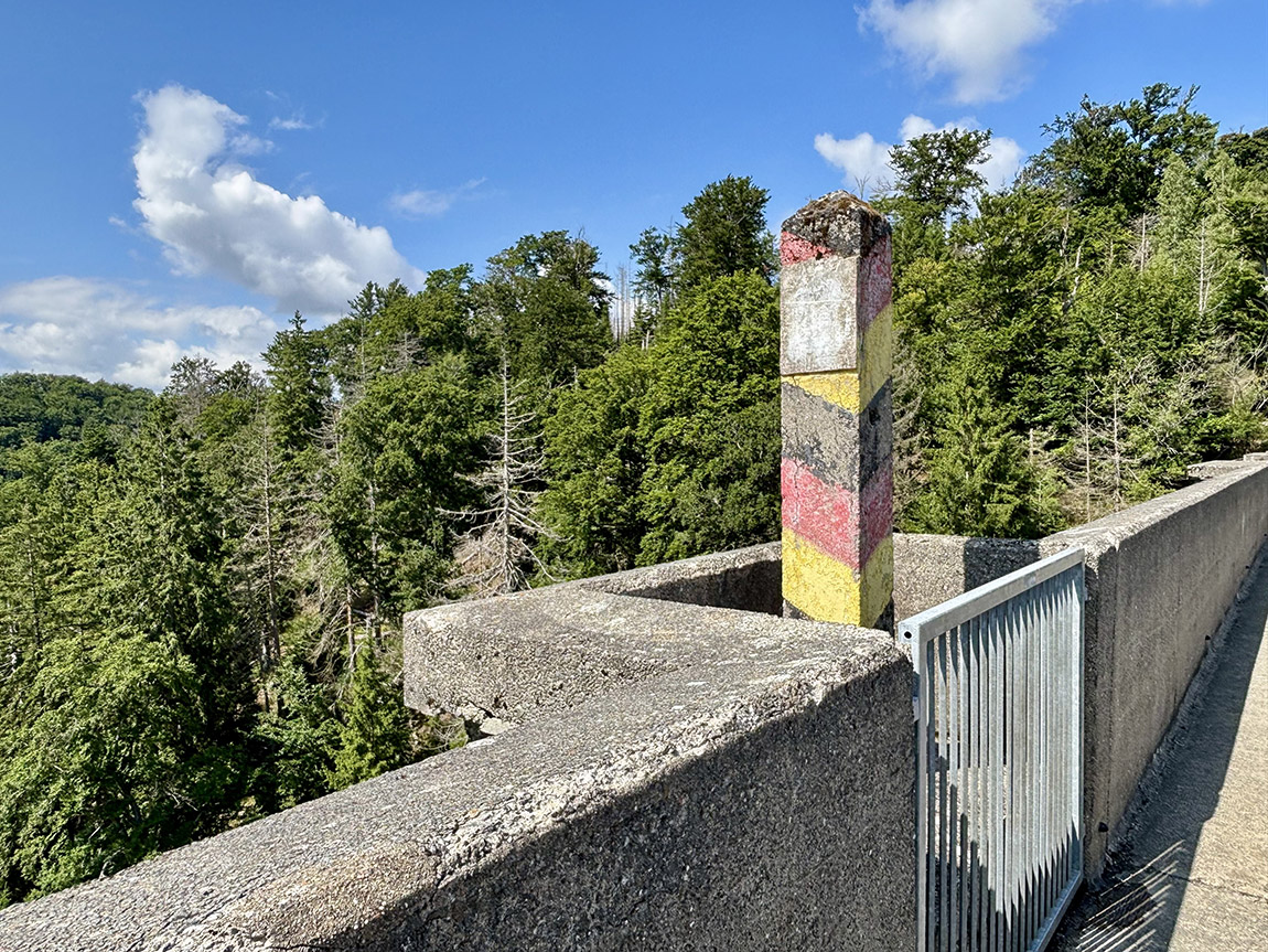
An old GDR border post on the Eckertalsperre.
The barrier on the dam’s crest (first a wall, then a metal fence) has long since been removed, but a striped GDR barber pole stands testament to this most atypical of border positions, its access rights having been agreed via bilateral agreements.
“The time after the border was opened was characterised by freedom, hope and confidence,” says Annett Drache, who admits that she never could have imagined seeing the border fall in such a short space of time.
“On a varied and challenging route,” she goes on, “hikers can experience the scenic diversity of the Harz Mountains and contemporary German history up close. The mountains are particularly attractive because there’s great biodiversity in a small area, due particularly to large differences in altitude. Tourism in the Harz Mountains would be unimaginable without an attractive network of trails connecting towns with a diverse natural environment.”
Beauty and biodiversity certainly appear to pull visitors as much as tangible relics of the past. While Harz’s painful past cannot be neglected, Drache and I surely are not alone in finding comfort from nature reclaiming a line that once turned a population into prisoners. Wildcats roam where there was an almost impenetrable border fence.
As in so many areas of Germany, it seems that in these majestic mountains, history has been carefully incorporated into the country’s very soil.
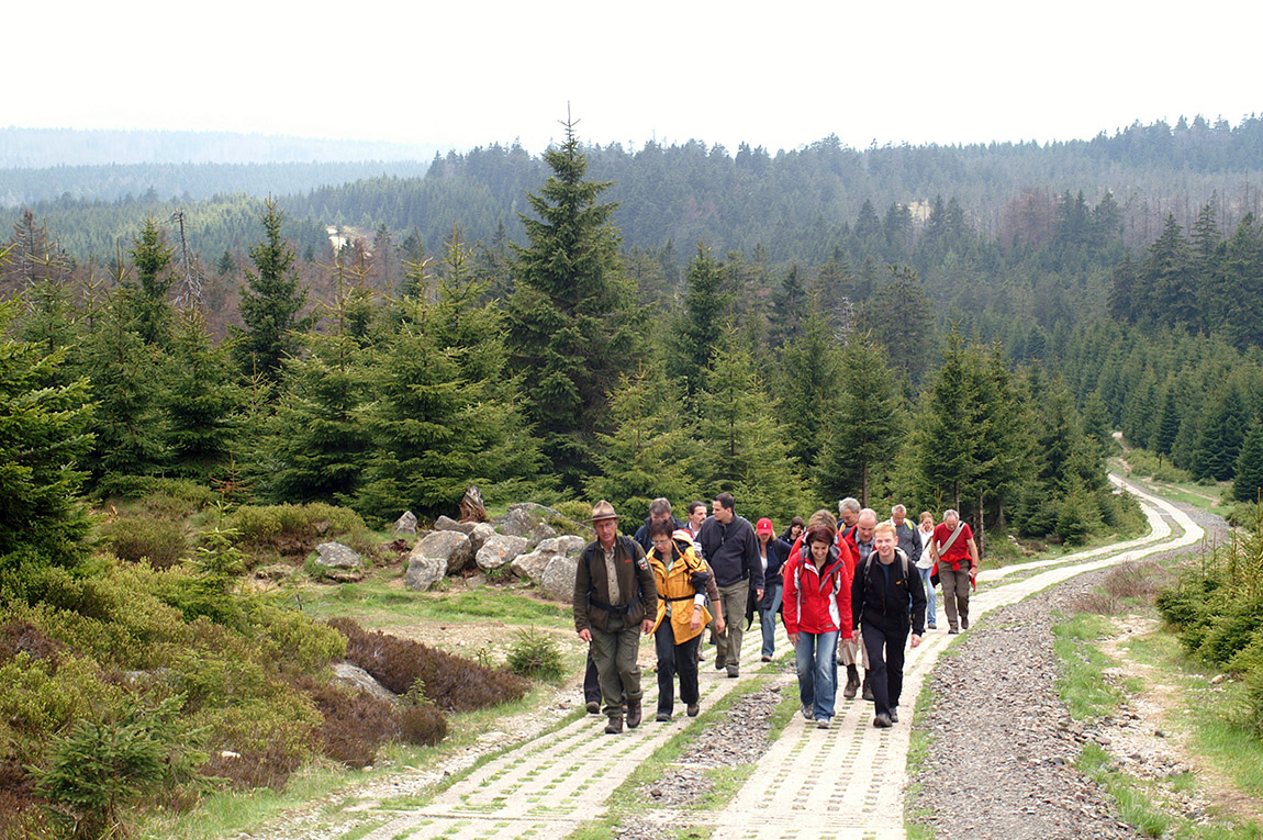
Walking on the Kolonnenweg, a former border patrol road. Photo: Harzer Tourismusverband

Subscribe to Our Newsletter
Receive our monthly newsletter by email